Latest Weather information on Winter Storm expected starting on Wednesday
December 20, 2022 11:35AM CST
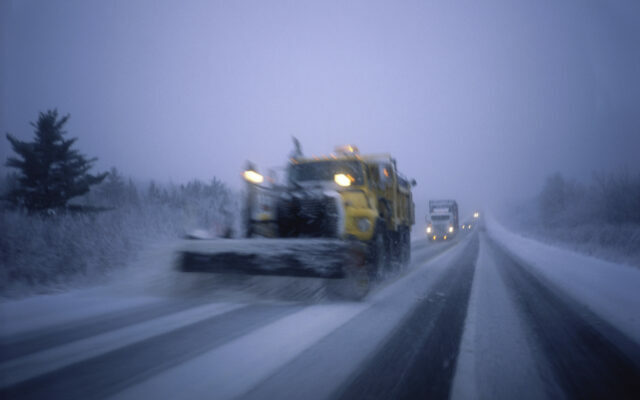
Snow plow on the road
...BLIZZARD CONDITIONS AND DANGEROUSLY COLD AIR LIKELY LATER THIS
WEEK...
...TRAVEL THURSDAY THROUGH FRIDAY NIGHT COULD BE IMPOSSIBLE AND
LIFE-THREATENING...

.Snow will overspread the region Wednesday and bring several
inches of fluffy accumulation through early Thursday. Winds will
be relatively light Wednesday and Wednesday evening. Then, strong
northwest winds gusting as high as 55 mph and dangerously cold
air will surge in Thursday through Saturday morning. Whiteout
conditions are expected during that time with travel becoming
very difficult or impossible. This event could be life-
threatening if you are stranded with wind chills in the 30 below
to 45 below zero range. Travel plans for late this week should be
adjusted now. In addition, heavy snow remaining on trees from the
last storm and strong winds arriving could result in tree damage
and power outages as temperatures drop below zero.

A Winter Storm Watch is in effect from Wednesday through late
Friday night for all of central and southern Minnesota and west
central Wisconsin. A Wind Chill Warning is in effect for western
and southwestern Minnesota Thursday morning through Saturday
morning. A Wind Chill Watch is in effect for central and south
central Minnesota Thursday morning through Saturday morning.

MNZ085-093-210015-
/O.CON.KMPX.WS.A.0006.221221T1800Z-221224T1200Z/
/O.CON.KMPX.WC.A.0001.221223T0000Z-221224T1800Z/
Steele-Freeborn-
Including the cities of Owatonna and Albert Lea
1015 AM CST Tue Dec 20 2022

...WINTER STORM WATCH REMAINS IN EFFECT FROM WEDNESDAY AFTERNOON
THROUGH LATE FRIDAY NIGHT...
...WIND CHILL WATCH REMAINS IN EFFECT FROM THURSDAY EVENING
THROUGH SATURDAY MORNING...

* WHAT...For the Winter Storm Watch, blizzard conditions
  possible. Total snow accumulations of 4 to 6 inches possible.
  Winds could gust as high as 55 mph. For the Wind Chill Watch,
  dangerously cold wind chills possible. Wind chills as low as
  40 below zero.

* WHERE...Steele and Freeborn Counties.

* WHEN...For the Winter Storm Watch, from Wednesday afternoon
  through late Friday night. For the Wind Chill Watch, from
  Thursday evening through Saturday morning.

* IMPACTS...Travel could be very difficult or impossible.
  Widespread blowing snow could significantly reduce visibility.
  Gusty winds could bring down tree branches. The dangerously
  cold wind chills could cause frostbite on exposed skin in as
  little as 10 minutes.

* ADDITIONAL DETAILS...This could be a life-threatening
  situation if you get stranded traveling late this week.
  Consider adjusting any travel plans now.
You Might Also Like